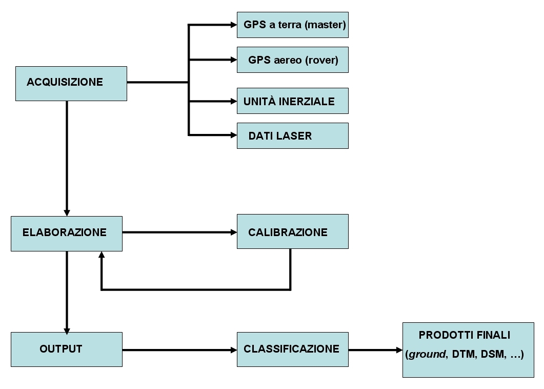
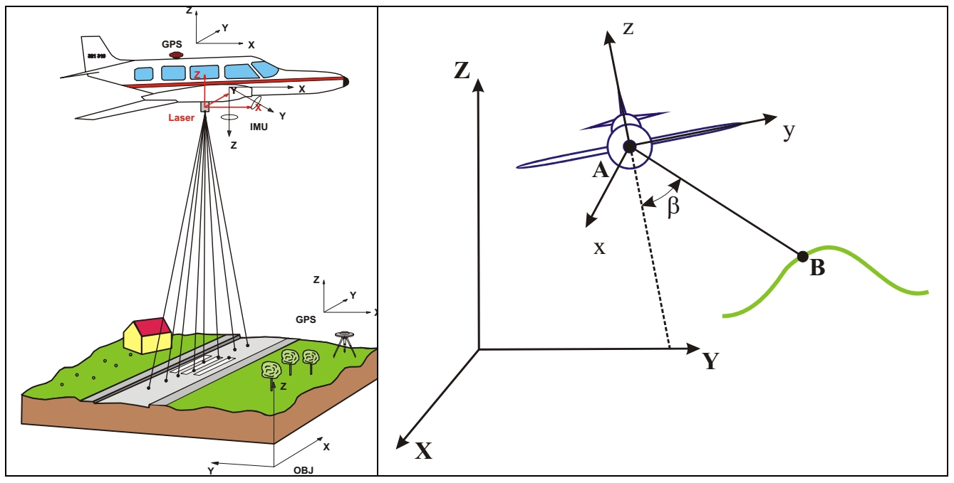
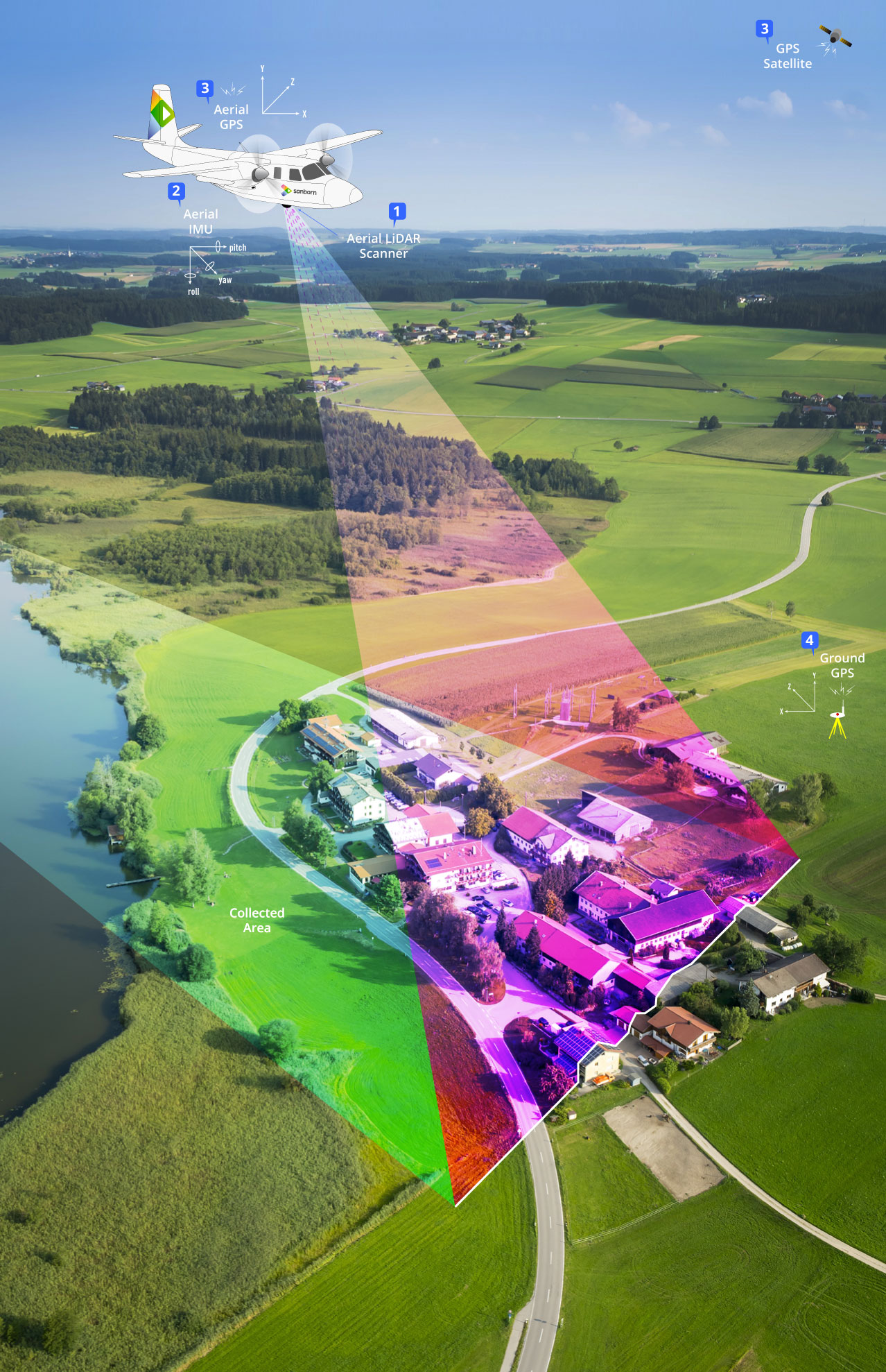
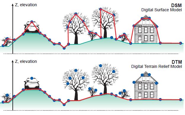
The LIDAR (Light Detection and Ranging) is an airborne scanning system, which uses the laser technique to obtain a digital model of the Earth's surface by detecting a high number of points (up to several points per square meter), characterized by high plano–altimetric precision (10-15 cm). The instrument measures the time for a laser beam to travel from the emission source, which is located on board an aircraft, to the surface and back; as speed of propagation of light is known, the measured times are subsequently converted into distances. The installation on board the aircraft of a GPS sensor and an inertial measurement unit (IMU) allows to determine the precise positioning and orientation of the aircraft at the time of propagation of the laser beam; combining this information with distance measurements, we obtain the three-dimensional coordinates of all the points on the ground hit by the laser. Through a LIDAR acquisition it is therefore possible to obtain digital models of the Earth's surface (DSM) that represent the topografic elevation of a territory, including the objects that are on it like buildings, trees and other artefacts. Through appropriate data filtering techniques, ie a semi-automatic distinction obtained by specific algorithms, it is possible to distinguish the points belonging to soil, vegetation and buildings, obtaining digital terrain models (DTM) which represent the soil surface without the anthropic and vegetational elements.
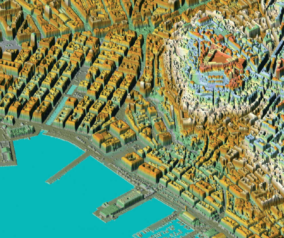
Modello 3D della città di Trieste ottenuto attraverso un rilievo Lidar