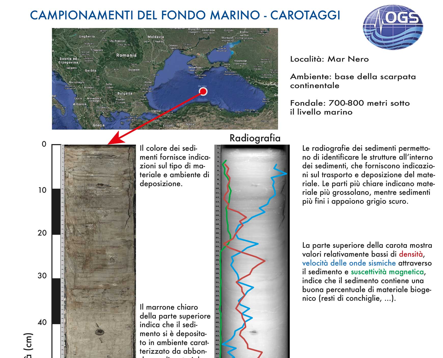
To sample rocks, sediments and ice, different tools are used according to the depth and the survey environments, in order to obtain the most intact samples as possible:
1) in the marine environment to sample unconsolidated surface sediments such as clays and sands, cores are used which, by gravity, penetrate up to tens of meters below the sea floor;
2) on the ground, for superficial sampling up to a few hundred meters, mechanical drilling probes are used;
3) to reach depths of thousands of meters wells are drilled, which can cross and sample both sediments and rocks by a hollow tube whose end is provided with chisels (in the percussion sounding) or diamond crowns (in the survey to rotation). At sea, specially equipped ships or platforms are used.
The samples extracted, called carrots, are analyzed to define the type of rocks and sediments and their physical, chemical and granulometric characteristics, age, porosity and permeability relative to the content of water and hydrocarbons, etc.
Generally, data obtained from the cores and wells are used to calibrate geophysical data (see reflection seismic) and to extract the obtained information on a larger area. The purposes can be multiple:
1) identification of the environments and the formation processes of rocks and sediments for the reconstruction of the geological evolution for different applications;
2) identification of levels containing fresh water, hot water and hydrocarbons;
3) characterization of the geotechnical properties of the subsoil for engineering purposes;
4) reconstructions of paleoclimatic sequences in sediment and ice cores through the use of indicators also called proxies (eg: oxygen and carbon isotopes, micropalaeontological analysis, sediment composition and texture, etc.).